Welcome to SDR
Mapping Solutions for 9-1-1 and Public Safety
Mailing Address: P.O. Box 684, Olathe, KS 66051
911/GIS Oklahoma
 SDRs GIS services are available to Oklahoma 911 entities through the Oklahoma 911 Mgmt. Authority and OMES State Contract. Grants are available from the Oklahoma 911 Management Authority for GIS improvement required for NG911. (https://www.ok.gov/911/documents/GIS%20GRANT%20PROJECTS.pdf) For a pre-assessment and proposal, or for more information about the grants and SDRs services and products, click here to email Matthew Knight, or call us directly at 800-238-1911 ex 701.
911/GIS Missouri

SDRs GIS services and software are available to Missouri 911 entities. Grants are available from the Missouri 911 Service
Board for Dispatch Mapping Software and upgrades, as well as GIS improvement required for 911. (https://www.missouri911.org/grants-and-funding-opportunities) For an overview of the software or pre-assessment and proposal, or for more information about the grants and SDRs services and products, click here to email Matthew Knight, or call us directly at 800-238-1911 ex 701.
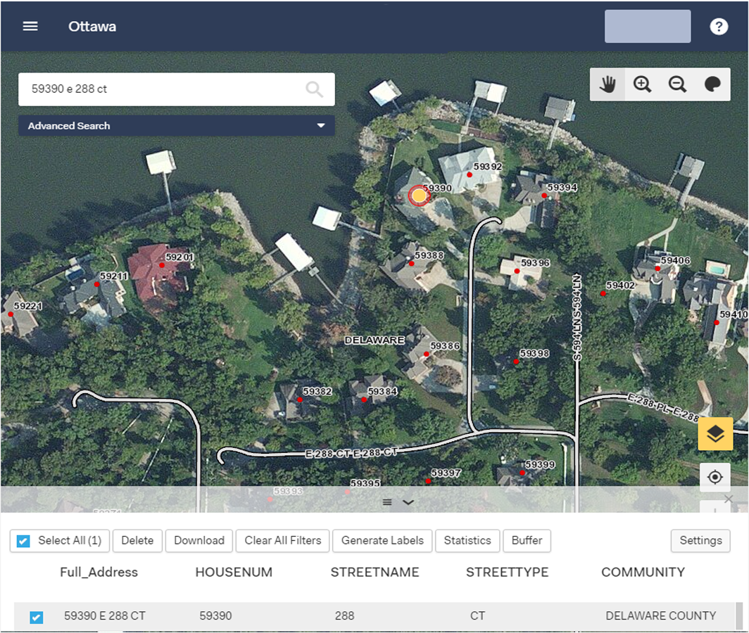
SDRs web mapping tools serve your locally created and maintained GIS data to the audience you choose via secure web interface and internet browser. Built on an ESRI platform with speed, efficiency and ease of use in mind, eCOP offers view, query and display tools plus secure log-ins so that specific users or user groups can access additional layers or features and can edit point, line and polygon data. eCOP is your tool of choice to quickly solve problems, improve your data and share your mapping with constituents and stakeholders.
Today, as location-based technologies gain greater and greater importance across all sectors, SDR clients use eCOP to reach a variety of end users who benefit from local mapping data, data that is simply not available on public mapping websites. These users include government offices, post offices, schools, residents, businesses, public safety agencies, and more.
For more information on eCOP and how your constituency can benefit from it, or to schedule a demonstration, contact us at 800-238-1911 or by e-mail.
Crawford County, MO 911 Go2It Dispatch Mapping & GIS Software
City of Rolla/Phelps County, MO
GIS Update & Improvement for CAD & Dispatch Mapping
City of Bedford, TX
GIS Improvement for
CAD & Dispatch Mapping
Oregon County, MO
GIS Addressing and USPS Address
Conversion
Carter, Wayne and Ripley Counties, MO
GIS and Rural Addressing
for 9-1-1
Hamilton County, IL
GIS Data Prep & Improvement for NG9-1-1
Moniteau County, MO
911 Go2It Dispatch Mapping & GIS Software
Henry County, MO
Readdressing and GIS Improvement for NG9-1-1
Marshall County, OK Addressing and GIS Maintenance for 9-1-1 Brown County, KS GIS Software Solutions for Addressing & 9-1-1 Dispatch St Francois County, MO AVL Integration for 9-1-1 Dispatch Mapping Gallatin County, IL GIS Improvement for NG9-1-1
Morgan County, MO 9-1-1 Go2It Dispatch Mapping CSI GIS for NG9-1-1 - Counties of Southern Illinois Carroll County, MO 9-1-1 Go2It Dispatch Mapping and Addressing/GIS Maintenance for 9-1-1 Saline County, IL City Address Point Mapping
AddressIt for ArcGIS
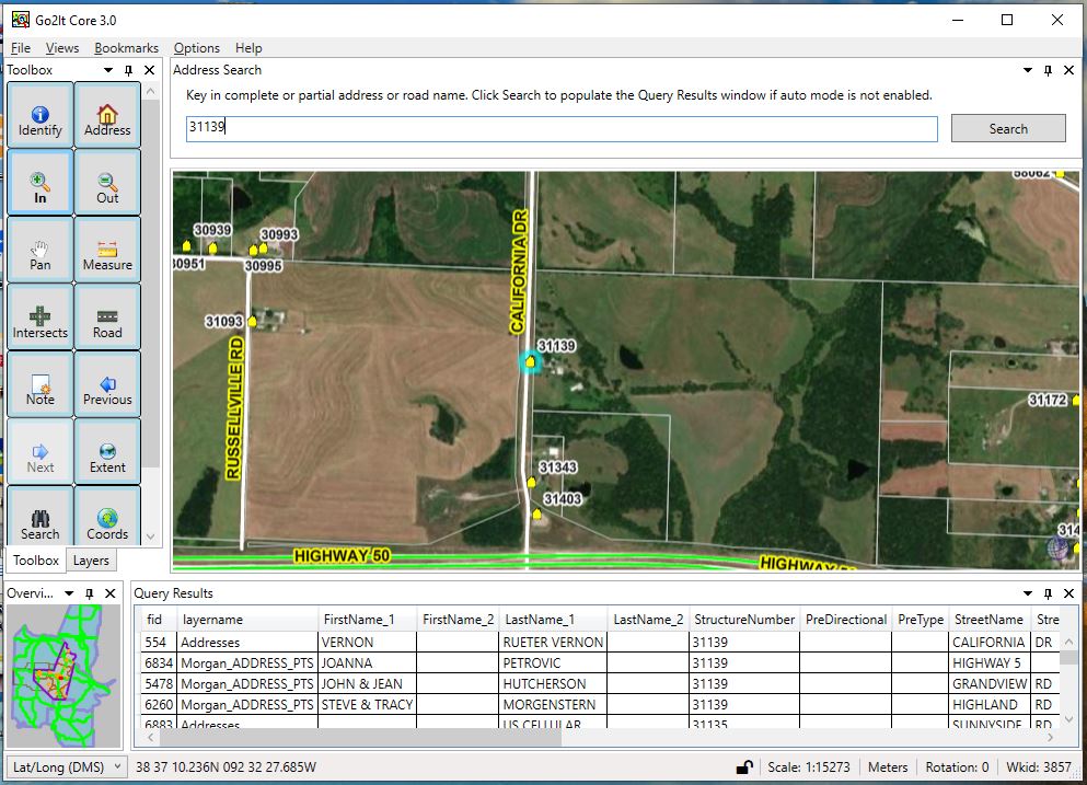
Go2It Dispatch Mapping
Go2It Responder in-vehicle Mapping
eCOP Web Mapping
 |
MPSCC Fall Conference
Springfield, Missouri
Sept 26 - 29, 2021
SDR offers cost-effective on-line training on a wide variety of topics in GIS, Addressing and 9-1-1.
A comprehensive list of topics is available on our training page